Posts

A Connectivity Case Study in Saarbrücken, Germany

Saarbrücken is a German city along the French border with a population of around 176,000 residents. Like most German cities, Saarbrücken’s core is a mix of walkable streets, urban buildings, and historic sites. Despite this, city leaders and residents are concerned about the future connectivity, mobility, and livability of their city.


Saarbrucken_Germany_Connectivity


A recent article in the local newspaper appeared under the title “Without Resolve There Is No Future,” lamenting the automobile’s takeover of the city in recent decades and the lack of planning for the future. Now, for the average American city, the article’s commuter statistics would be a dream: 4% ride bikes, 11% carpool, 17% use public transportation, 23% walk, and 45% drive to work alone. In contrast, over 75% of Americans drove to work alone in 2013. For a comparison, Saarbrücken’s numbers are similar to much larger American cities like Philadelphia or Seattle.


Now leaders are engaging citizens to create a 2030 Transportation Plan. The plan will cover six major goals, including fostering sustainability through public transit and cycling, accessibility, livable streets, and safety. But this isn’t the city’s first initiative to create a more livable city. Here are five ways Saarbrücken has been promoting connectivity in the past two decades:


1. The Pedestrian is [Becoming] King


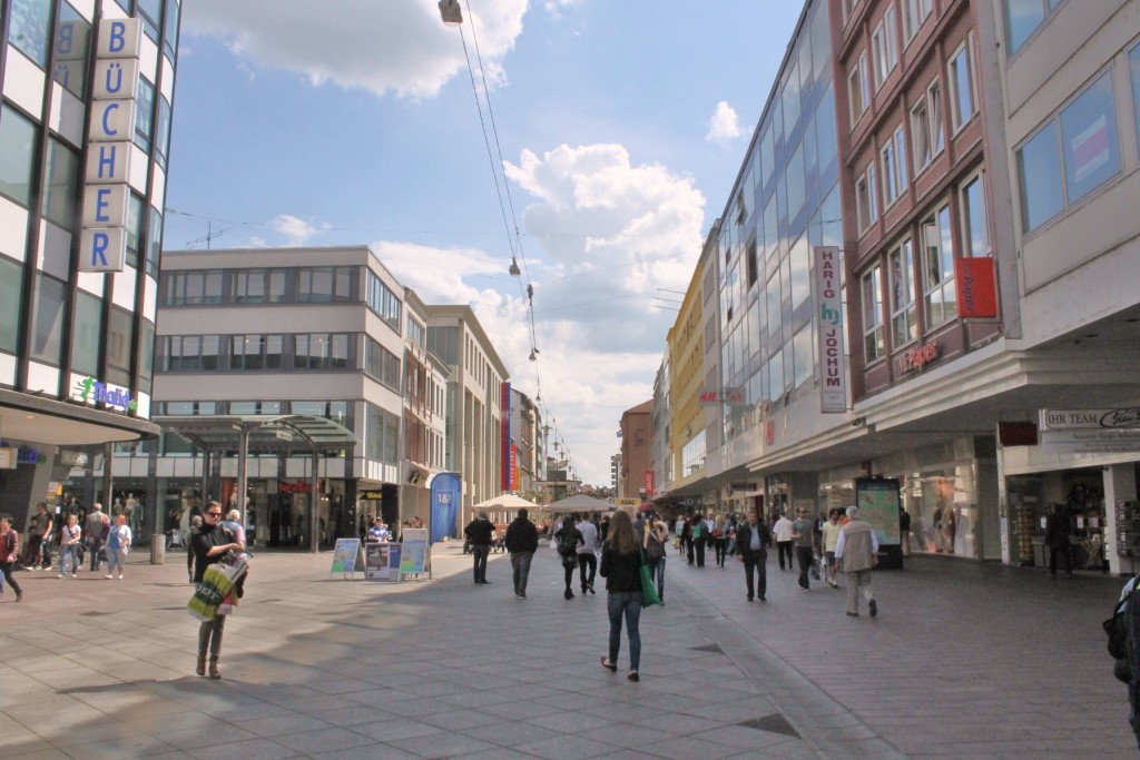
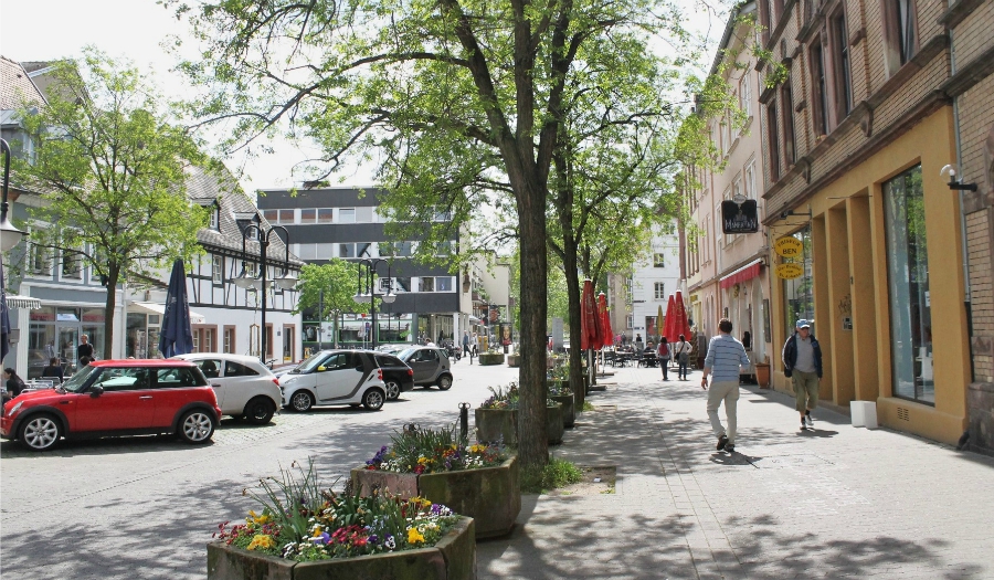
Saarbrücken’s main commercial corridor, the Bahnhofstraße, saw multiple incarnations in the past century. Bustling dirt roads with horse-drawn carriages gave way to streetcars in the 1890s. Then, after a nearly complete destruction during World War II, Saarbrücken’s main drag slowly reemerged in the 1950s and ’60s. But shiny new buildings weren’t the only difference along the Bahnhofstraße. By 1965, cars and diesel busses had completely replaced the extensive network of streetcars. For the next 30 years, the Bahnhofstraße looked like many American cities’ main streets: narrow sidewalks, angled parking, and a constant stream of cars.


Bahnhofstraße, Saarbrücken, Germany


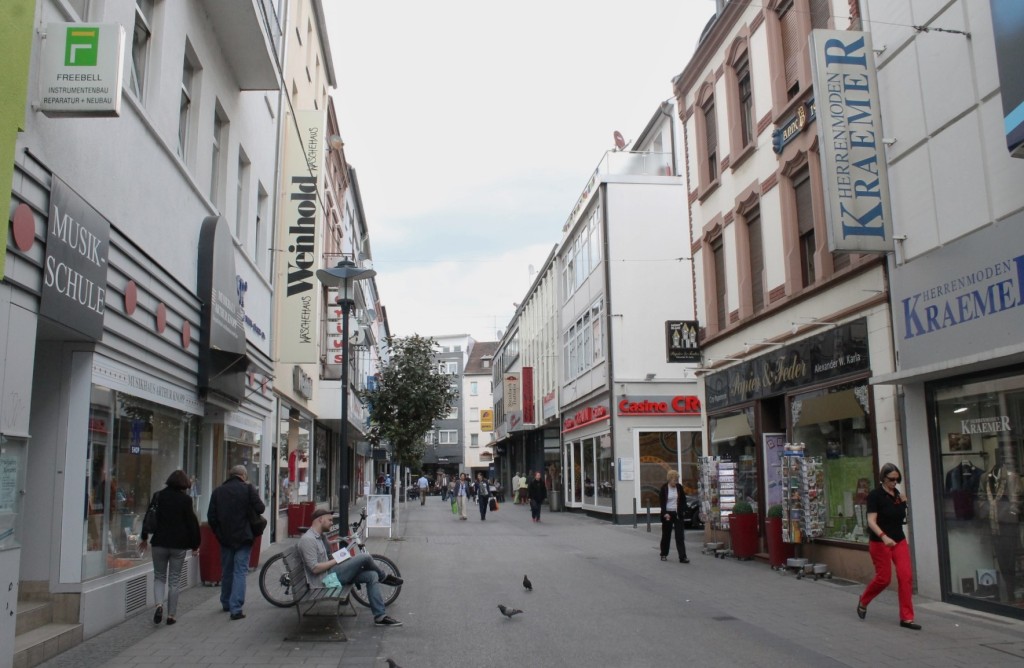
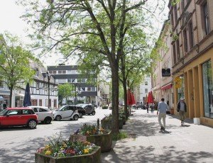
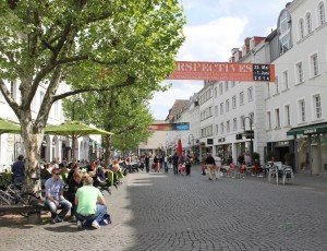
A big shift came in the 1990s with the first pedestrianization efforts. Today, the entire length of Saarbrücken’s Bahnhofstraße (about one mile) is reserved solely for pedestrians. This effort continues today, with many side streets being converted into Woonerf-like pedestrian- and bike-friendly environments.


Woonerf, Saarbrücken, Germany


2. An International Streetcar


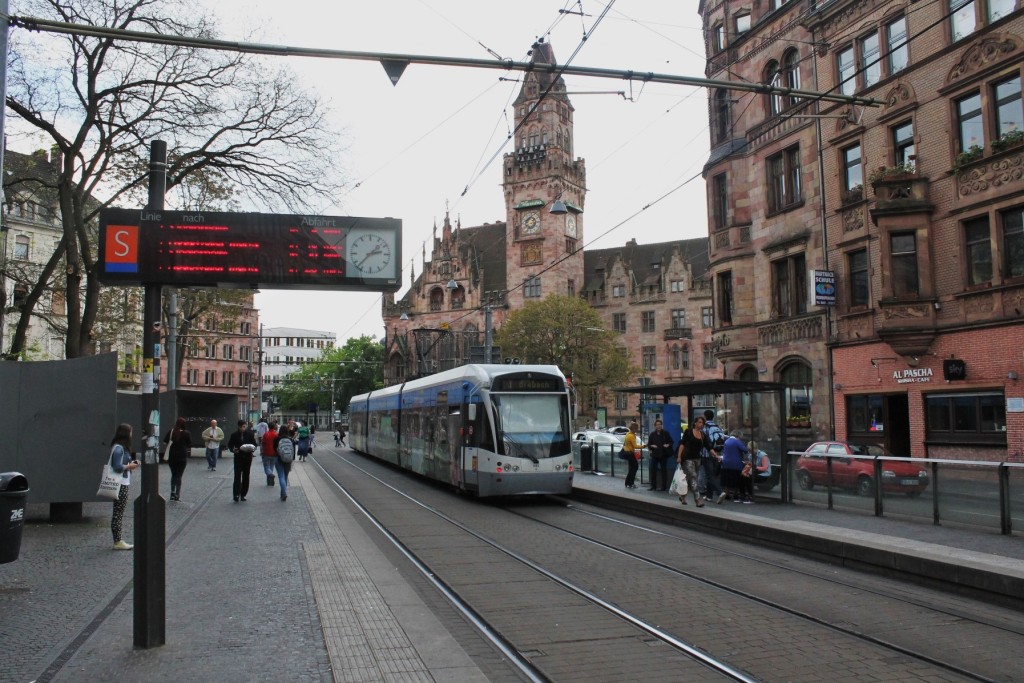
Although Saarbrücken’s streetcar system closed down in 1965, the Saarbahn revived the former Line 5 in 1997 as Line S1 and has seen multiple extensions since then. Today, this “regional streetcar” serves 40,000 riders per day at 43 stations and runs over 27 miles through Saarbrücken and various smaller cities. The core is served at 7.5-minute intervals, while farther out neighborhoods and towns are served in 15-, 30-, and 60-minute intervals. What makes the Saarbahn special is that its last stop, Sarreguemines, lies in France, making it not only a regional but also an international streetcar.


Saarbahn, Saarbrücken, Germany


3. Bike Parking


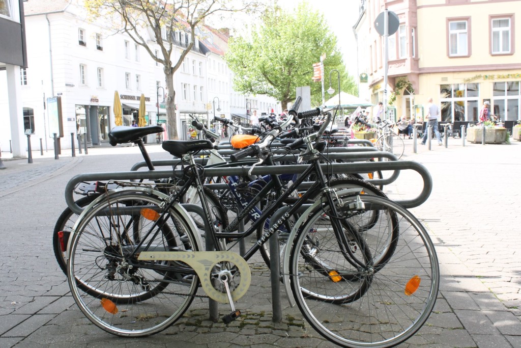
While only 4% of Saarbrücken commutes by bike, bike parking can be found throughout the city. With a goal of getting at least 10% of commuters on bikes in the next few years, bike parking and cycle tracks are a major part of future transportation plans.


Bike Parking, Germany


4. A Multi-Modal Waterfront


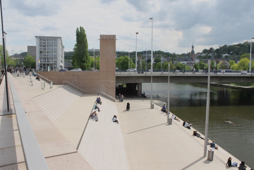
While the Saar river is the namesake for, well, just about everything in Saarbrücken, the riverfront itself seems to have been an afterthought in the Bahnhofstraße renovations of the 1950s and ’60s. That changed in the past year, however, with the project Stadtmitte am Fluss, or City Center on the River. With updated lighting, renovated storefronts, upgraded accessibility, and new greenspaces, the city hoped to activate a neglected portion of its downtown waterfront.


Stadtmitte am Fluss, Saarbrücken, Germany


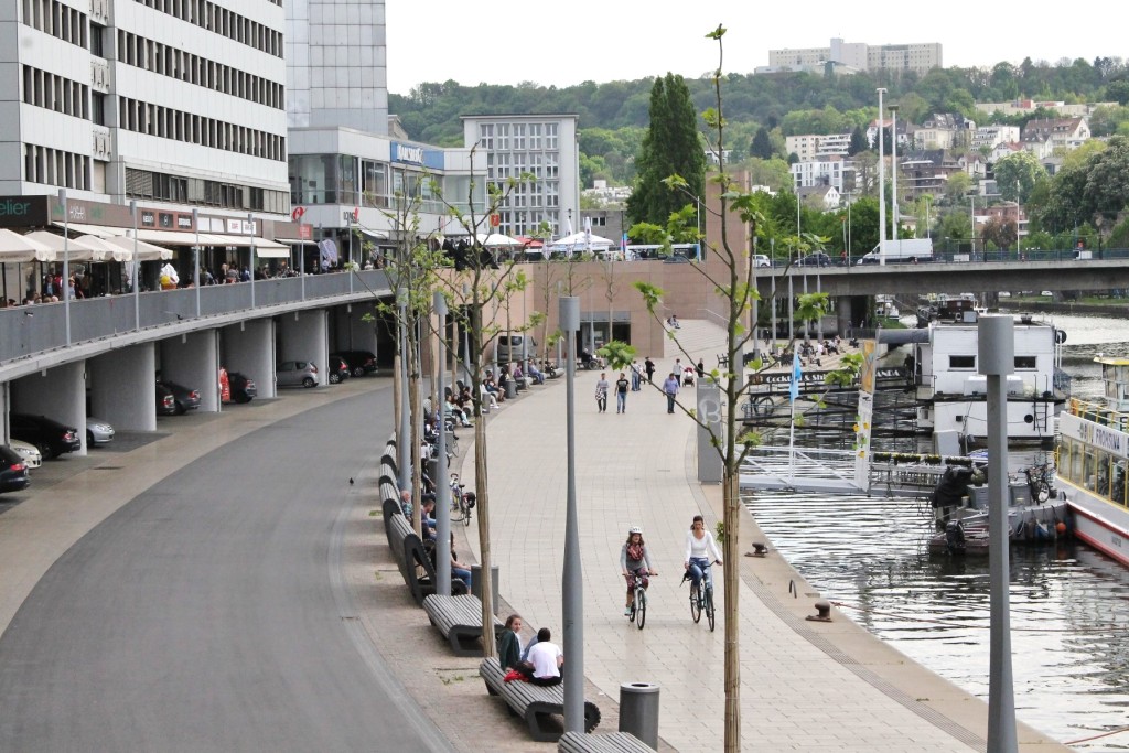
While the project was met with skepticism over costs and necessity, it was completed successfully and has brought new life–and connectivity–to the city’s core. An improved multi-modal trail connects existing riverside paths for a great walking and biking network.


Stadtmitte am Fluss Trail, Saarbrücken, Germany


5. Saarbrücken: A City to Explore on Foot


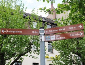
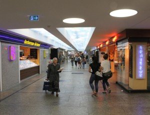
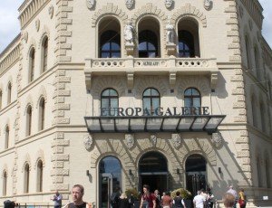
With all the pedestrian streets mentioned above, it’s no surprise that 23% of Saarbrückers commute on foot and that the streets are always filled with shoppers. Smaller initiatives, however, have played a big role in getting people out of their cars. For example, sidewalks have been widened, directional signage with walking distances is commonplace, underground shopping tunnels allow pedestrians to avoid crossing large streets, an existing historic building was converted into a mall in 2010, and café seating spills out onto sidewalks throughout the city.



Implementing Streetcars: Lessons from Atlanta

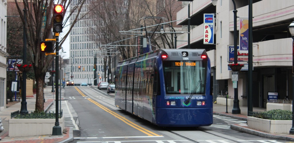
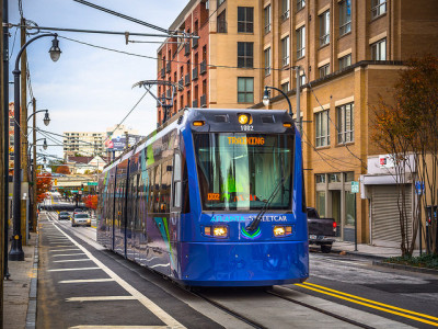
The streetcar fits a unique niche in our transportation system different from bus or light rail. It’s often described as an extension of the walking environment thanks to its ability to be used for short trips, while still connecting different neighborhoods within a city. However, as recent streetcar projects like the Downtown Loop in Atlanta have shown, their success requires patience.

streetcar_atlanta_downtown_loop

Photo © Matt Johnson via flickr

When to Implement Streetcars

In late 2014, Atlanta joined a growing number of US cities to add the modern streetcar to their available transit options. For Atlanta, the new Downtown Loop is the city’s first line since the original streetcar system closed in 1949. In a recent New York Times article, Keith T. Parker, the Chief Executive of MARTA, was quoted saying this about the new three-mile line:

“These are not projects for right now. These are projects for the future, and when you look around, the cities who we’re competing with around this nation and around the world, they’ve made investments in public transportation.”

This sentiment mirrors what we wrote in our previous post on streetcars: they are community builders. More than a mode of transportation, they aid in neighborhood revitalization. This means that cities can implement streetcars at strategic times and for specific purposes: to encourage transit-oriented development in new communities, to spur investment in underserved areas, or to provide a much-needed transportation alternative in bustling urban areas. No matter when streetcars are implemented in a city’s timeline, it takes time for them to become integrated into the urban landscape and into the habits of local residents and visitors—especially in places new to this type of fixed transit.

Where to Implement Streetcars

So perhaps it’s the growing pains of implementing a streetcar route in an existing urban fabric that has caused mixed reviews for Atlanta’s Downtown Loop. One notable piece was written by Atlanta magazine’s own Rebecca Burns, who chronicled her commute to work for an entire week using the new line. In addition to observing Atlanta’s overall lack of transportation options once at work, Burns’ biggest frustration was the speed of the streetcar: the line operates in regular vehicular traffic. While her ride provided shelter from the elements and a chance to catch up on email, in an auto-centric city of nearly half a million people, sometimes sitting in gridlock remains a reality.

streetcar_implementation_atlantaStill, a streetcar that operates in a regular traffic lane is not doomed to fail. One benefit of mixing the streetcar with cars is the ability to use an existing street lane without having to remove it. Taking out auto travel lanes can be controversial or impractical in many locations and completely new rails require additional planning and funding. However, in congested areas, an exclusive lane will make service not only faster but also more reliable and therefore more usable by non-tourist travelers.

Right now, the Atlanta Streetcar’s biggest challenge seems to be the need to prove its usefulness not only for tourists, but also for professional commuters, residents, and students. As the community grows around the new route and residents integrate it into their daily lives, the streetcar is sure to become an important cornerstone for downtown Atlanta.

 Photo © Central Atlanta Progress via flickr

A Brief Look: What is a Multi-Way Boulevard?

Streets, roads, courts, avenues, boulevards—cities use these words to name a range of street types. But in transportation design, each one describes a very specific type of thoroughfare. In this Brief Look, we’ll see what makes a thoroughfare a multi-way boulevard and why they are great placemaking solutions.

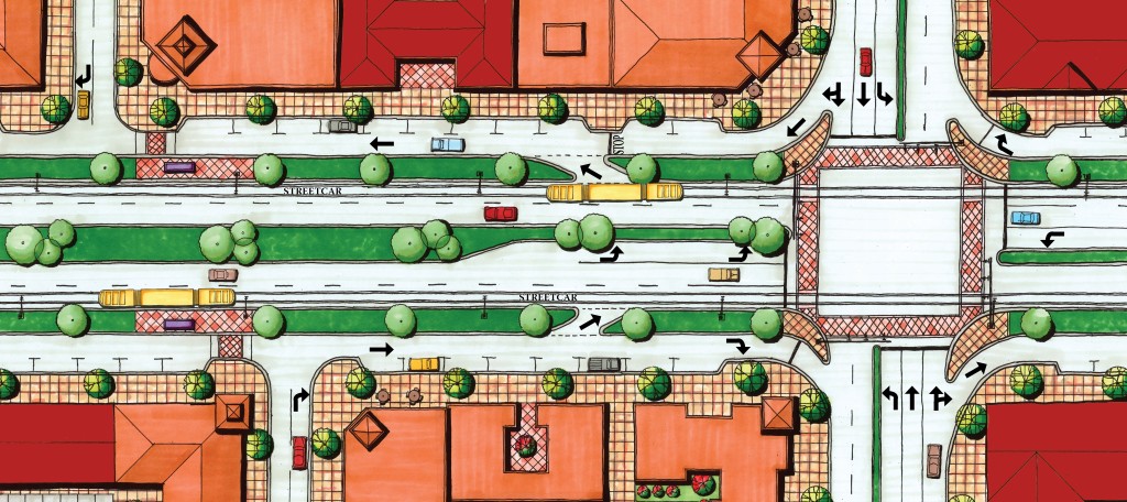
Typical Boulevard Plan View


The term “boulevard” is broadly used to describe a street or promenade planted with trees. For planners and engineers, however, a boulevard is also a highly valuable piece of roadway that can accommodate multiple users and types of movement within an urban design framework. We generally refer to this as a multi-way boulevard.

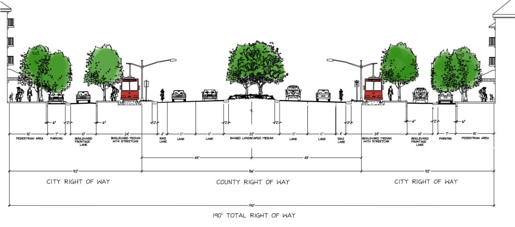
A multi-way boulevard contains three essential elements: central through lanes, parallel frontage lanes (coupled with an inviting pedestrian realm), and landscaped tree lawns (to buffer low speed users from through traffic). Beyond these core ideas, there can be a good deal of variety in the specific design, such as the location of transit and additional pedestrian or bicycle facilities.

One of the biggest challenges facing urban designers and traffic engineers is designing a roadway that accommodates the expectations of transportation officials while at the same time providing a safe, walkable environment that promotes pedestrian, bicycle, and transit uses. This is where the central through lanes provide the needed vehicular capacity, while frontage lanes create a calm, multi-use environment that lends itself to urban commercial and mixed-use development opportunities.

Boulevard with Streetcar


Multi-way boulevards come with many more benefits: they are aesthetically pleasing, accommodate on-street parking without interfering with through traffic, and create opportunities for buildings to interact with the sidewalk. Nonetheless, some challenges may exist in their application. Their higher cost and potential need for additional right-of-way must be acknowledged before design implementation can begin. Furthermore, a lack of existing engineering design standards means that only those with a strong understanding of roadway design can develop them.

From handling high volumes of traffic to providing fully functional pedestrian infrastructure, multi-way boulevards are a serious option for designing and redesigning large-scale thoroughfares in urbanizing areas.


Streetcars Then and Now

Streetcars were a primary mode of transportation in America’s urban areas at the turn of the last century. In 1902, they carried 5.8 billion trips and provided quality transit service to compact, walkable cities. However, as cars began to dominate the post-war streetscape, streetcars fell from prominence.

Today, tastes in the United States are changing. Or, more accurately, they are leaning back to what they were before. Long commutes and worsening congestion are making urban and walkable lifestyles more desirable. With a changing national demographic that favors the urban life, cities are once again exploring streetcars as a way to catalyze the development and redevelopment of walkable neighborhoods.

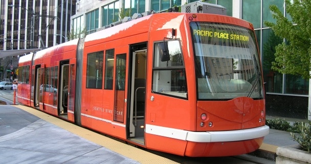
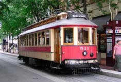
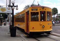
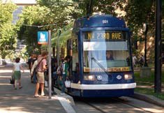
Streetcars Old and New
Photo via Stephen Rees

Streetcars for Neighborhood Revitalization

Streetcars are more than just a form of transportation: They are city builders. But what type of development best compliments the streetcar? Generally, they are well-suited for higher-density, mixed-use buildings. A variety of mixes may include commercial, office, and residential uses. Residential densities should be at least 20 to 30 units per acre. Meanwhile, densities exceeding 100 units per acre can ensure good ridership.

Still, it’s important to remember that these mixes and densities don’t need to be present from day one. In fact, an essential role of streetcars is to help build such neighborhoods. Once established, they benefit from the ridership they produce. Fixed-transit provides a reliable development environment for private investors and an easy-to-understand first transit experience for new urban dwellers.

Streetcar installations have spurred high-quality, mixed-use development along corridors in cities such as Portland, Oregon; Kenosha, Wisconsin; and Tampa, Florida. In Portland, studies showed that the combination of streetcars and good development policies helped spur $2 billion dollars in private-sector investment. Meanwhile, the total public investment in streetcars was $57 million. Moreover, ridership was almost triple the initial projections.

Streetcar Types

Since its earliest conception, the streetcar has changed shape many times. Today, three varieties prevail. Each style has its benefits and drawbacks, but all three can compliment the character of the neighborhoods in which they’re placed.

Restored Historic Streetcar


  • Historic character
  • Typically lowest-cost vehicle
  • Difficult to find identical vehicles and parts
  • Low passenger capacity
  • ADA access at stops
  • Slower operating speeds and passenger boarding

Heritage Style Streetcar


  • Historic character
  • Lower vehicle cost
  • Simplified fleet maintenance
  • Low passenger capacity
  • ADA access at stops
  • Slower operating speeds and passenger boarding

Modern Streetcar


  • Modern image
  • Higher vehicle cost
  • Simplified fleet maintenance
  • Larger passenger capacity
  • ADA access in vehicles
  • Faster operating speeds and passenger boarding

Master-Planned Communities in a New Economy

Inarguably, conventional growth patterns coupled with the recent economic rollercoaster have left urban planners scratching their heads. A major question remains: How can we create new, master-planned communities with a robust framework to prepare for an unpredictable housing market in the future? To find the answer, municipalities and developers are looking back at historical growth patterns for inspiration. But instead of only using a New Urbanist design approach, planners are focusing on economic factors more than ever before.


The City of Edgewater, Florida, has taken this new approach to heart. The approval of a form-based code will guide the 20-year build-out of Restoration, the city’s Sustainable Community Development District. As noted in Better Cities & Towns, Restoration is the largest post-recession traditional neighborhood development planned to date. To ensure its success, the 1,315 acre project must balance two factors: economic feasibility and smart design.


To guarantee economic viability, the Restoration code allows a frugal, incremental build-out. The master plan includes a variety of phasing options responsive to market conditions. It begins with single-story commercial buildings and modestly-sized homes, building up to an eight-story town center that will likely be developed in later stages. Furthermore, businesses will have a great deal of flexibility on where they can locate to meet the demand of new residents’ changing numbers and needs.


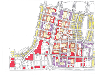
Historical growth pattern in Restoration features a multi-way boulevard ready for a streetcar.


The hallmark of Restoration’s traditional design will be a transit-ready boulevard designed to accommodate a four-mile streetcar system. Other important factors for creating a livable environment include:

  • Providing a range of different environments, from residential districts to mixed-use blocks.
  • Building forms, regardless of their uses, must respond to a walkable scale.
  • Organizing buildings around an urban grid.
  • Placing green spaces in primary locations to create a healthy public realm.


The goal of Restoration’s code is to allow a new, walkable place to evolve authentically, while remaining resilient through changing market conditions. A traditional development will be built to create an active community with the resilience to weather future market fluctuations.