Posts

A Vision for Mercy Drive

Mercy_Drive_Meeting

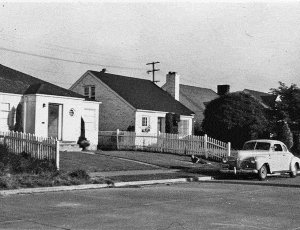
Hidden behind the Central Florida Fairgrounds and nestled between College Park and Pine Hills, Mercy Drive is a predominantly African-American community with a unique mix of single family neighborhoods and a variety of large and small apartment complexes housing moderate and low-income families. Additional pockets of commercial, industrial, and institutional development are scattered along its main street, Mercy Drive, as well as some recreational uses such as the City of Orlando owned and operated Northwest Community Center.

The community has had its challenges, ranging from traffic concerns to the closure of several poorly maintained apartment complexes that are now in City ownership. Limited transportation connections in the area make Mercy Drive a popular cut through, especially for freight truck traffic from the nearby industrial properties.

Recognizing the need for a unified visioning approach, and under the leadership of Commissioner Regina Hill, the City retained Canin Associates to work with the residents and stakeholders to create a forward-looking Vision Plan to improve the community’s quality of life and bring out residents’ talents to build a better future for their families and their community.

“A safe, attractive, and connected community with quality homes and apartments that empowers neighbors of all ages to learn, build, and create together.”
-Mercy Drive Vision Statement

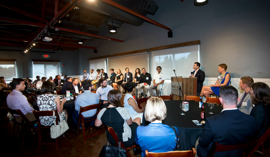
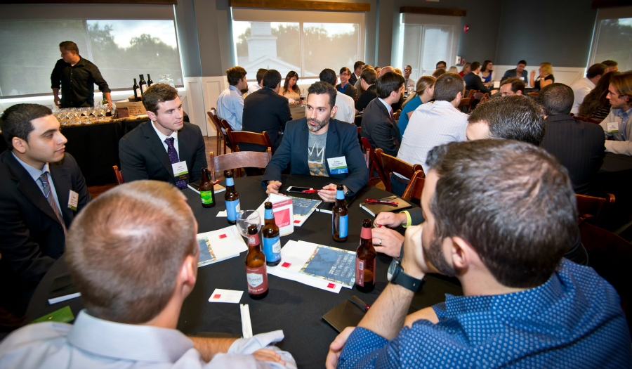
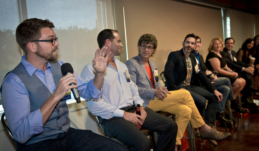
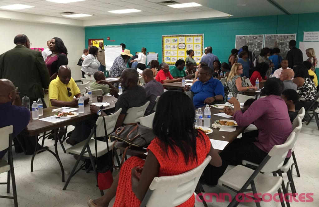
The visioning process kicked off with over 100 residents and stakeholders in attendance at the first of three public meetings to be held within the community at the Northwest Community Center. After analyzing the information gathered from the first meeting as well as from an area-wide walking audit, expert interviews, and a housing conditions assessment, a second public meeting was held to present a vision statement as well as physical design and community building concepts. Residents and stakeholders then voted on which of the concepts they thought were most appropriate for their community’s future.

Mercy_Drive_NHC_Render

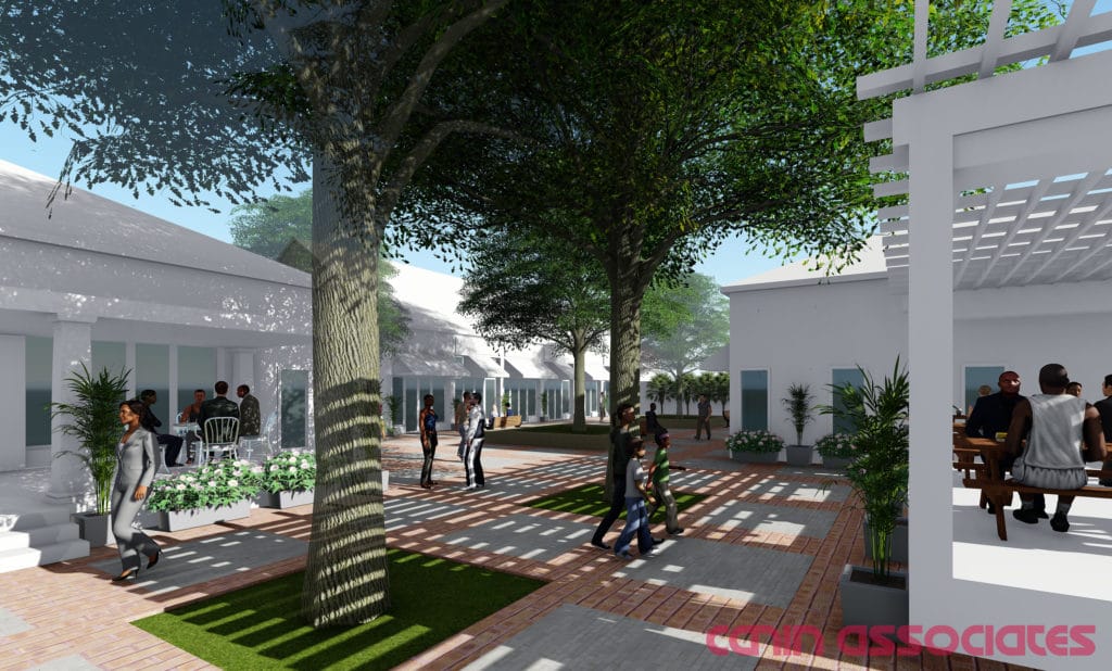
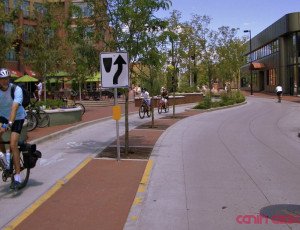
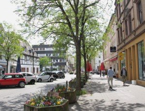
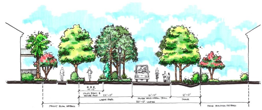
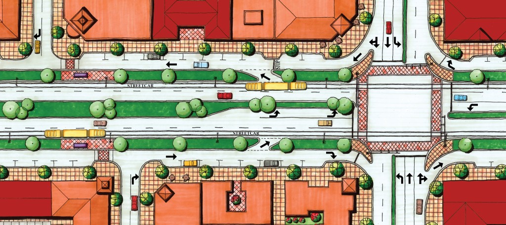
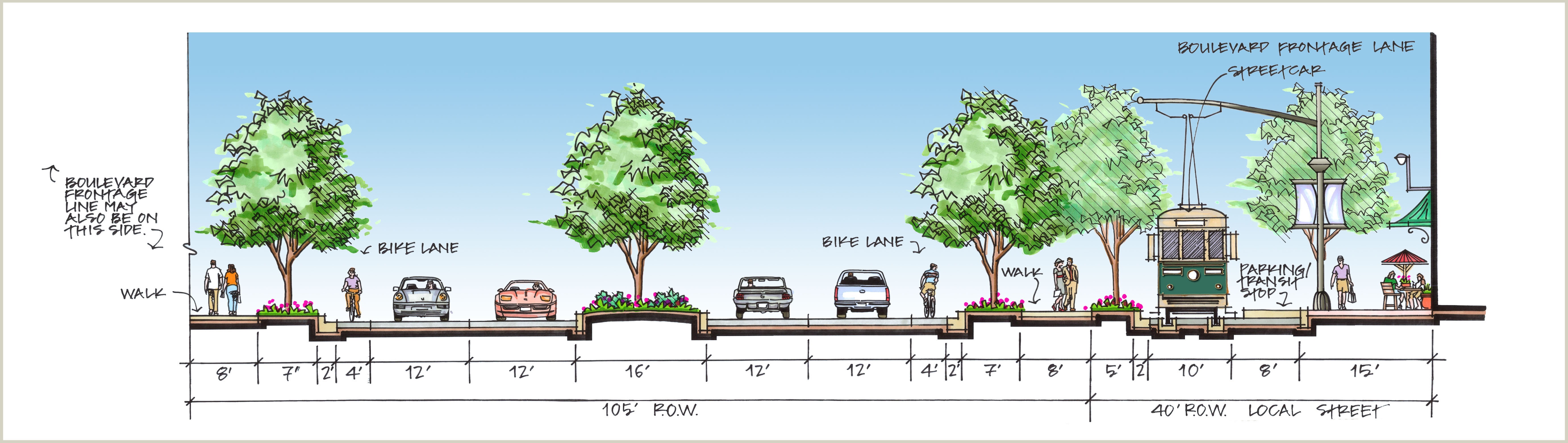
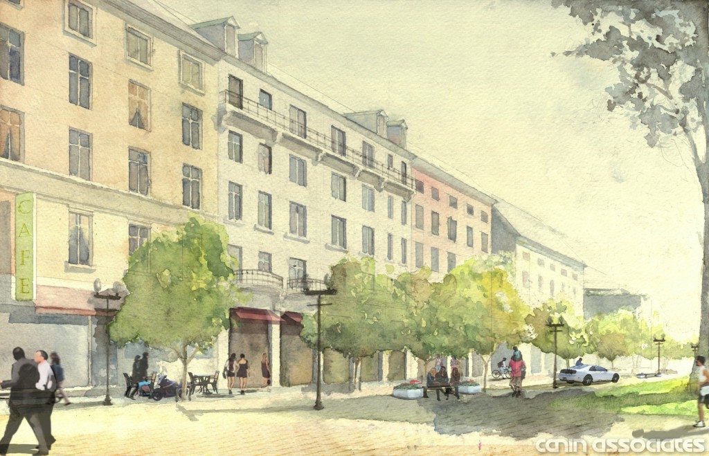
The design concept that received the most votes was a multi-use neighborhood center that provides public gathering space along with new commercial and small business opportunities. Streetscape enhancements to help mitigate traffic issues, improve walking and biking, and provide community gateway features came in a close second place along with ideas for new higher density single-family housing opportunities on a couple of City-owned parcels.

The community building programs that received the most votes were focused mainly on home maintenance, such as a tool lending library and home repair classes, as well as increasing community-wide events, some of which could even include partnering with the Orlando Police Department.

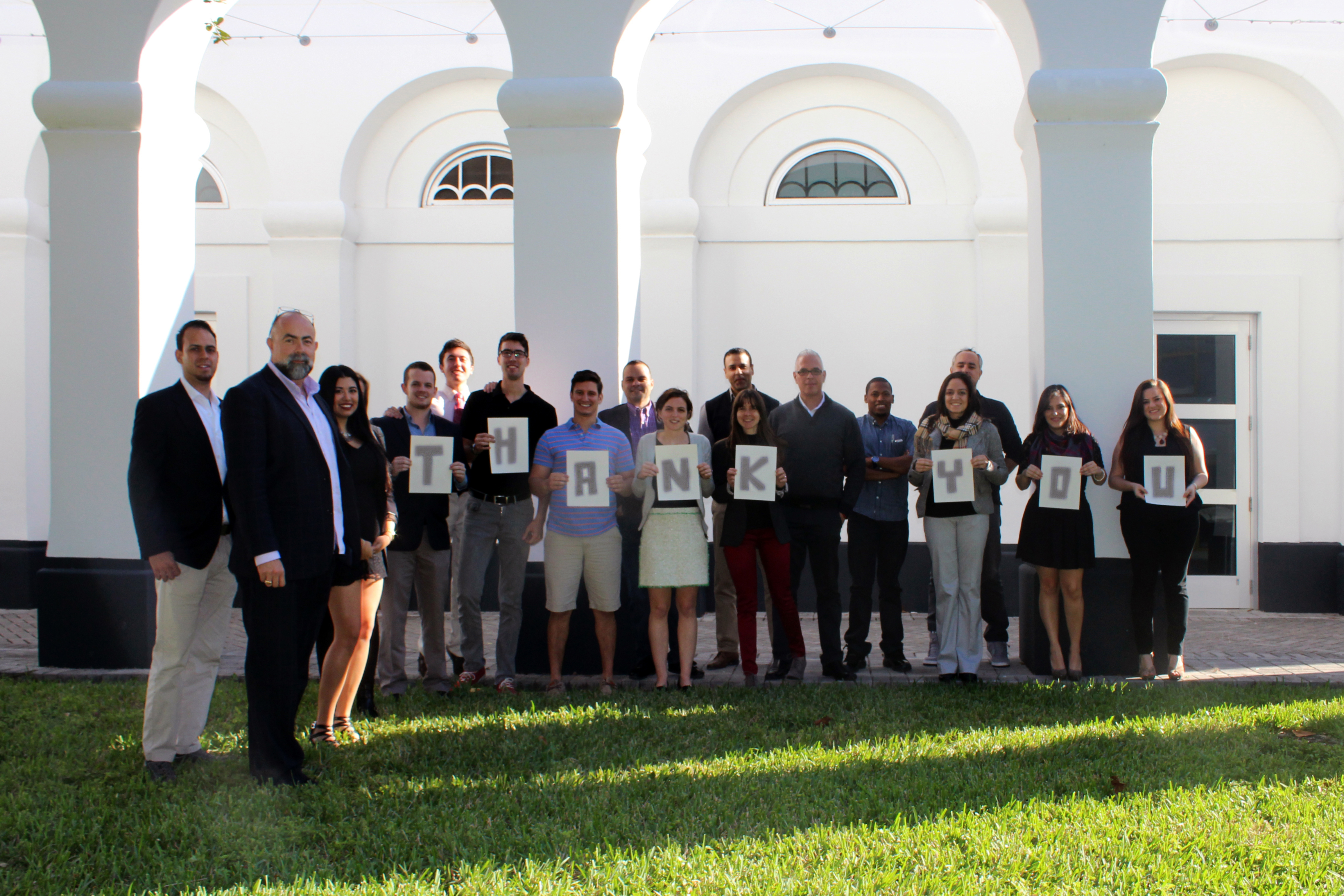
With the community’s priorities determined, a vision report was produced that will help guide both public and private investment for current and future Mercy Drive residents. The executive summary of this report was distributed during the third and final public meeting, which was in the form of a community resource fair. This final meeting brought multiple city departments, third party organizations, and more into the Northwest Community Center to engage with residents and stakeholders, and to help begin the process of realizing their community’s new vision.

Canin Associates is proud to have partnered with the City of Orlando and Mercy Drive residents and stakeholders in developing the vision for their future. We look forward to what will be coming next for this high-potential community!

Visit the City of Orlando’s project page for access to the final vision report documents and additional information.

Our 5 Top Posts of 2015

Happy New Year! Like most of you, we hit the ground running in what is sure to be a busy and exciting 2016. Nonetheless, we want to take a quick look back at some of our favorite posts from the past year. From streetcars in Atlanta to architecture in Lima, we took a look at mobility, buildings styles, and a new way to approach single-family homes.

Bike Lanes - Pros and ConsBike Lanes or No Bike Lanes: A False Dichotomy?

In many cities, a false dichotomy has dominated recent conversations around cycling: Should bicycle-riders travel on their own specialized networks of bike lanes or should they ride on any road alongside automobiles?


Saarbrücken SidewalkA Connectivity Case Study in Saarbrücken, Germany

Like most German cities, Saarbrücken’s core is a mix of walkable streets, urban buildings, and historic sites. Despite this, city leaders and residents are concerned about the future connectivity, mobility, and livability of their city.


Peru - Cusco - ArchitectureThree Architectural Periods in Peru

Peru as a country boasts a mix of cultures, climates, and architecture. What makes it an incredible place to visit is that modern Peru seamlessly blends together its diverse history.


Single-Family Homes in an Urban EnvironmentSingle-Family Can Be Urban, Too

American housing design is in need of a paradigm shift. Recognizing generational preferences, increasing affordability constraints, and sustainable solutions are needed to start a new chapter in the planning of our cities, especially when it comes to housing. But that doesn’t mean the single-family home is dead.


streetcar_implementation_atlantaImplementing Streetcars: Lessons from Atlanta

The streetcar fits a unique niche in our transportation system different from bus or light rail. It’s often described as an extension of the walking environment thanks to its ability to be used for short trips, while still connecting different neighborhoods within a city. However, as recent streetcar projects like the Downtown Loop in Atlanta have shown, their success requires patience.


Lake Flores Brings New Urbanism to Southwest Florida

“A positive example of change,” “the right development at the right time,” and “a life-preserver” were just a few of the positive comments heard during August’s Manatee County Commission meeting to review the Lake Flores project. At the meeting, Commissioners unanimously approved the initial development plan for Lake Flores.


Lake Flores Manatee County Florida Development


As a result, over 1,300 acres of farmland surrounded by existing suburban development in west Manatee County will come back to life as the mixed-use residential infill community of Lake Flores. “This is the best thing since Lakewood Ranch,” said one of the participants at the meeting, unknowingly citing another project in Manatee County designed by Canin Associates. Begun in 1995, Lakewood Ranch is a successful 17,500-acre master-planned community.


The heart of Lake Flores will be the 19-acre namesake lake and its surrounding urban park. Interlaced with these greenspaces are community areas, events spaces, and a new Main Street that will be home to restaurants, shops, and entertainment. During its 20-year buildout, Lake Flores is set to grow into bustling, walkable neighborhoods with 6,500 residential units, 3 million square feet of commercial and retail space, and 500 hotel rooms.


Lake-Flores-Florida-Site-Master-Plan-3


As a true mixed-use community, Lake Flores will offer a variety of housing options and a transportation system that supports a diversity of users. Apartments overlooking Lake Flores will create a peaceful yet urban residential option for young professionals while master-planned neighborhoods will focus on innovative single-family housing types. Meanwhile, the streets and multi-use trail system will move more than cars: people on foot, on bike, and in small electric vehicles will be able to explore Lake Flores conveniently and safely.


“From an economic standpoint, this is very positive for Manatee County and the area,” Lake Flores property owner and lifelong area resident Whiting Preston told the Bradenton Herald. Not only will the development attract newcomers to the area, but current residents—especially young adults looking to buy their first homes—will be able to stay in Bradenton due to the array of housing choices. This notion is underscored by two distinct business centers which will promote job growth in the commercial, research, and development sectors.


Multi-Modal-Trail-Urban-Planning-1024x432


Lake Flores is poised to reignite Bradenton and west Manatee County as a very special place to live. As an infill community, Lake Flores will provide housing and retail/office space in a location where it is needed. As a mixed-use, traditional neighborhood, Lake Flores will grow into a walkable, New Urban addition to the region that will be attractive to Millennials, families, and retirees.


ULI Central Florida: Visionaries Discuss the M-Factor

Last week, I had the chance to attend ULI Central Florida’s signature YLG event A Night with Visionaries of Central Florida: The M-Factor. Hosted by the Young Leaders groups from ULI Central Florida, CREW Orlando, and NAIOP Central Florida, this latest edition provided a platform for visionaries and young professionals to discuss the impact Millennials are having on a wide array of real-estate-related fields.


ULI Event Recap


The program consisted of a series of roundtable discussions with some of Central Florida’s most influential leaders. During each seven-minute segment, a new visionary shared valuable insights within the areas of urban planning, development, philanthropy, healthcare, education, sports and entertainment, law, architecture, and technology. Proceeds from the event directly supported US Hunger. The group of Visionaries, and some of their observations on Millennials, included:

Don Campbell, Founder, US Hunger

“Social media is a powerful tool that Millennials respond to, but it doesn’t necessarily get them out to volunteer. We find that it’s our great work culture that’s attracting more interns in a world where volunteering is decreasing.”

Carlos Carbonell, CEO, Echo Interaction Group

“You don’t have to be a programmer to start a tech company—you can leverage that excitement and solve other problems through technology.”

ULI_Central_Florida_Visionaries_Recap3

Pauline Eaton, Main Street Coordinator, City of Orlando

“Millennials are looking for communities that have an authentic, unique identity.”

David Harrison, Professor of Real Estate, University of Central Florida

“In our program, we’re actively reaching out to find out how to improve our education, both in real estate and in tangent fields.”

Ken LaRoe, CEO & Chairman, First Green Bank

“We’re the first values-based financial institution on the East Coast. Millennials are drawn to organizations with a values-driven mission and sustainable practices.”

Leila Jammal Nodarse, Senior Principal, Terracon

“Millennials want to feel like they can bring ideas forward, especially ideas that support community.”

ULI_Central_Florida_Visionaries_Recap2


John Rife, Owner, East End Market

“Millennials are interested in authentic projects that meet area-specific needs and are not franchised. Through social media, pop-ups as precursors, and flex spaces, we can let demand shape those projects.”

David Stone, Director of Architectural Services, Phil Kean Design Group

“Being involved in professional organizations helped me make connections offline and online that led to connecting with and working for Phil Kean.”

Joshua Wallack, COO of Mango’s Tropical Café and Managing Principal at Skyplex

“In Orlando, your project needs enough power to rise above the noise to compete with what’s already out there—and to attract part of the 62 million visitors as well as the local market.”

Jim Zboril, President, Tavistock Development Group

“At Lake Nona, we’re attracting Millennials by expanding the variety of housing products, including Canin Associates’ Jewel Box homes, that meet the needs of young buyers while providing a lower price of entry.”


Photos by Chris Gotshall Photography


A Connectivity Case Study in Saarbrücken, Germany

Saarbrücken is a German city along the French border with a population of around 176,000 residents. Like most German cities, Saarbrücken’s core is a mix of walkable streets, urban buildings, and historic sites. Despite this, city leaders and residents are concerned about the future connectivity, mobility, and livability of their city.


Saarbrucken_Germany_Connectivity


A recent article in the local newspaper appeared under the title “Without Resolve There Is No Future,” lamenting the automobile’s takeover of the city in recent decades and the lack of planning for the future. Now, for the average American city, the article’s commuter statistics would be a dream: 4% ride bikes, 11% carpool, 17% use public transportation, 23% walk, and 45% drive to work alone. In contrast, over 75% of Americans drove to work alone in 2013. For a comparison, Saarbrücken’s numbers are similar to much larger American cities like Philadelphia or Seattle.


Now leaders are engaging citizens to create a 2030 Transportation Plan. The plan will cover six major goals, including fostering sustainability through public transit and cycling, accessibility, livable streets, and safety. But this isn’t the city’s first initiative to create a more livable city. Here are five ways Saarbrücken has been promoting connectivity in the past two decades:


1. The Pedestrian is [Becoming] King


Saarbrücken’s main commercial corridor, the Bahnhofstraße, saw multiple incarnations in the past century. Bustling dirt roads with horse-drawn carriages gave way to streetcars in the 1890s. Then, after a nearly complete destruction during World War II, Saarbrücken’s main drag slowly reemerged in the 1950s and ’60s. But shiny new buildings weren’t the only difference along the Bahnhofstraße. By 1965, cars and diesel busses had completely replaced the extensive network of streetcars. For the next 30 years, the Bahnhofstraße looked like many American cities’ main streets: narrow sidewalks, angled parking, and a constant stream of cars.


Bahnhofstraße, Saarbrücken, Germany


A big shift came in the 1990s with the first pedestrianization efforts. Today, the entire length of Saarbrücken’s Bahnhofstraße (about one mile) is reserved solely for pedestrians. This effort continues today, with many side streets being converted into Woonerf-like pedestrian- and bike-friendly environments.


Woonerf, Saarbrücken, Germany


2. An International Streetcar


Although Saarbrücken’s streetcar system closed down in 1965, the Saarbahn revived the former Line 5 in 1997 as Line S1 and has seen multiple extensions since then. Today, this “regional streetcar” serves 40,000 riders per day at 43 stations and runs over 27 miles through Saarbrücken and various smaller cities. The core is served at 7.5-minute intervals, while farther out neighborhoods and towns are served in 15-, 30-, and 60-minute intervals. What makes the Saarbahn special is that its last stop, Sarreguemines, lies in France, making it not only a regional but also an international streetcar.


Saarbahn, Saarbrücken, Germany


3. Bike Parking


While only 4% of Saarbrücken commutes by bike, bike parking can be found throughout the city. With a goal of getting at least 10% of commuters on bikes in the next few years, bike parking and cycle tracks are a major part of future transportation plans.


Bike Parking, Germany


4. A Multi-Modal Waterfront


While the Saar river is the namesake for, well, just about everything in Saarbrücken, the riverfront itself seems to have been an afterthought in the Bahnhofstraße renovations of the 1950s and ’60s. That changed in the past year, however, with the project Stadtmitte am Fluss, or City Center on the River. With updated lighting, renovated storefronts, upgraded accessibility, and new greenspaces, the city hoped to activate a neglected portion of its downtown waterfront.


Stadtmitte am Fluss, Saarbrücken, Germany


While the project was met with skepticism over costs and necessity, it was completed successfully and has brought new life–and connectivity–to the city’s core. An improved multi-modal trail connects existing riverside paths for a great walking and biking network.


Stadtmitte am Fluss Trail, Saarbrücken, Germany


5. Saarbrücken: A City to Explore on Foot


With all the pedestrian streets mentioned above, it’s no surprise that 23% of Saarbrückers commute on foot and that the streets are always filled with shoppers. Smaller initiatives, however, have played a big role in getting people out of their cars. For example, sidewalks have been widened, directional signage with walking distances is commonplace, underground shopping tunnels allow pedestrians to avoid crossing large streets, an existing historic building was converted into a mall in 2010, and café seating spills out onto sidewalks throughout the city.


Alleys in Urban Design: History and Application

A Short History of Alleys


Alley in Croatia by Dennis Jarvis

While alleys have existed in old world cities since the middle ages, they have had a limited level of utility in the recent American urban landscape. In the 19th century, American cities used alleys to hide the more utilitarian, less attractive functions of urban life including service and servant access, barns for horses and carriages, and even small shops and areas for children to play. However, the 20th century saw alleys nearly eliminated from the American urban landscape.


A number of events took place in the past century that contributed to the demise of the alley. Zoning segregated land use in such a way that many of the alley’s uses were redirected to distinct, separate districts. The automobile grew not only as America’s primary mode of transportation, but also as a status symbol. As such, home designs began to feature front loaded garages, allowing the automobile to be proudly displayed for all to see. Simultaneously, government spending focused on building high-speed roads and emphasizing home ownership, creating suburbs in lieu of cities. This “suburban” way of thinking about what communities should look like and how they should function was a shift away from compact, mixed-use development, causing alleys to be dismissed as costly wastes of space.


The Role of Alleys Today


In the 21st century, Americans are once again embracing the benefits of urban life, including walkability and compact mixed use development. Along with this “new urbanism,” we find ourselves once again embracing the alley as playing a critical role in the function of our cities and community development. Alleys are now a common feature in the design and redesign of our communities.


An alley in Winter Park, Florida.

 An alley leads to shops and restaurants in Winter Park, Florida.


The primary role of alleys has traditionally been to hide the more unsightly functions of our communities; the garages, garbage cans, transformers, electric meters, and telephone equipment. However, today their other positive impacts are celebrated as well: making possible narrower lots as garages are now accessed from the rear as opposed to being a prominent feature in front of a residence, enhancing safety as sidewalks and pedestrians become separated from the access requirements of vehicles, providing additional building access for firefighters, and creating a more casual neighborhood space adjacent to back yard activity centers, which leave the front of the house as a more formal community space.


Additionally, alleys are regaining their historic function as access for accessory housing units, providing a greater diversity of housing choices within our neighborhoods. We are also finding new uses for alleys, such as the Green Alley Movement, started in Chicago, which transforms alleys into greener community spaces which perform their traditional functions in addition to beautifying neighborhoods and reducing rainwater runoff. In older cities, alleys are being rediscovered as people places.


Applying Alleys


As with most urban design elements, a one-size-fits-all approach to alleys does not work. Alley specifications need to work within the framework of their surroundings. Alley design will vary depending on the uses within the alley: the character of residentially bounded alleys will differ from those that are found in commercial and industrial settings. Designers can implement a variety of alley sections, with variations occurring in pavement widths, garage setbacks, one-way or two-way access, parking locations, and service accessibility.


Alley-loaded homes in Baldwin Park, FL.

 Alley-loaded homes in Baldwin Park, Florida.


To ensure our new alleys work as they are intended, there is a need to coordinate the design, function, and development of alleys with many stakeholders. It’s not only designers that need to be involved in the process of determining what is the best alley design for a community or project, but also communities and their leaders, city planners, utility companies, solid waste removal providers, fire departments, public works departments, and developers all need to be brought to the table when alleys are being considered.


CNU Florida Summit 2015: Our Takeaways

Last week, members of the Congress for the New Urbanism convened in Orlando for the 2015 CNU Florida Summit. The event’s theme was Transit and Transects: Sparking Florida’s Urban Revival. Speakers and tours covered topics including the rebirth of Downtown Orlando, the return of rail transit to Central Florida, and the development of urban neighborhood centers. Below, six Canin Associates team members share their takeaways from the two-day conference:


2015 CNU Florida Summit


Eliza Harris, Canin Associates Orlando“We were pleased to hear Billy Hattaway [District 1 Secretary, Florida Department of Transportation] talk about taking the connection between land and transportation seriously. The new standards will help urban state roads support community building.”

Eliza Harris, Director of Urbanism


jtcinquemani_150“The conversation about the successful conversion of College Park was really interesting, especially how the design of our main streets plays a fundamental role in how we think and feel about our community. The public realm is such an essential part of every community, and fully utilizing the economic, environmental, and social benefits is key.”

JT Cinquemani, Architectural Designer


elena_haas“As a newcomer to both CNU and Orlando, I was surprised by how much more I learned about the city, and how much New Urbanism is shaping it. Behind the scenes, Orlando is implementing many more New Urbanist principles than I realized.”

Elena Haas, Intern Architectural & Interior Designer


monica_pinjani

“Seeing several projects at different stages and in unique contexts helped me rethink the approach to design and its impact on end users. Since the challenges of urbanization are universally similar, it’s great to see how teams react to each project’s specific context with innovative solutions.”

Monica Pinjani, Urban Designer


Alex_Lenhoff_CNU“I found it interesting that important design elements that used to be optional are now required in many jurisdictions. It was inspiring to see policy and design begin to take steps in the same direction.”

Alex Lenhoff, Urban Planner


michael_richardson“It was refreshing to be reminded of the strong directional opinions at play in building and design-related industries. Despite overall progress, leaders continue to find creative ways to deal with the current social and built environments on a more detailed scale.”

Michael Richardson, Architectural Designer


More information on individual sessions and speakers can be found in the 2015 CNU Florida Summit Agenda.


Canin Award Funds Student Trip to Medellín, Columbia

Last fall, a group of students and professors from the University of Miami School of Architecture had the opportunity to visit Medellín, a Columbian city now famous for implementing a series of smart urban solutions in the past decade. Canin Associates is thrilled to have been able to help make this trip possible, along with support from the University of Miami Citizens Board.

Miami_Architecture_Canin_Medellin_Columbia

Medellín as a city has garnered a lot of attention in the past few year, from being named Innovative City of the Year in 2013 to hosting the United Nations World Urban Forum in 2014. Not only have city leaders and citizens actively reduced the cartel-induced crime that plagued the city for decades (the name “Murder Capital of the World” may come to mind), they also dedicated themselves to fostering social urbanism, a form of people-focused urban development. Today, outdoor escalators and a streetcar-like gondola line connect the city’s hilly outskirts to the center of town. A state-of-the-art library is paired with a new park to create the Parque Biblioteca España, one of the city’s architectural icons. These projects are mirrored by many more smaller scale initiatives with a focus on community building.

Canin Award Funds Thank You

In Medellín, young designers from the University of Miami studied the city’s architecture and saw first-hand the importance of innovative urban interventions. The students turned their experiences abroad into 11 proposals. Their visions focused on the future of the up-and-coming area around the Cemetery of San Lorenzo. Students presented their final concepts for “Studio Medellín” last December, and Professor Carmen Guerrero will create a report collecting these designs and the lessons learned on the group’s trip.


5 Takeaways from Harvard Design’s Miami Weekend

Last week, my alma mater was kind enough to bring the alumni event to us here in Florida for the first time. The Harvard Graduate School of Design held its Alumni + Friends Weekend in Miami, coinciding with Art Basel and Design Miami. The three-day meeting included a series of presentations, discussions, and site tours led by local and national experts in architecture, landscape architecture, and urban design. Below, I share the top five takeaways and trends to give you an intimate look into the GSD Weekend.

Miami_Design_District

Paseo Ponti in Miami’s Design District

1. Everyone is passionate about cities.

During A Conversation at Arquitectonica, three of the company’s original founders discussed the ties between New Urbanism, contemporary architecture, and the comeback of cities. They reflected on how their own companies’ shared history mirrors the larger conversation around the future of cities: with both traditional and avant-garde practitioners taking different paths to bring the American city out of negative cycles of the 1960s and 70s. Bernardo Fort-Brescia, Laurinda Spear, and Elizabeth Plater-Zyberk talked about creating the modern-focused Arquitectonica and the branching off by Plater-Zyberk (with fellow Arquitectonica co-founder and Congress for the New Urbanism co-creator Andrés Duany) to form DPZ with a focus on urbanism both in cities as well as greenfield towns.  Fort-Brescia discussed how their early projects focused on bringing housing into the city which at the time was viewed as a place for business only. Plater-Zyberk discussed how their work at Seaside led to a much larger conversation about the future of cities. They also spoke about how their differing educational backgrounds at Yale, Columbia, and Princeton influenced their outlooks on architecture.

2. Miami21 is making buildings more urban.

It’s one thing for skyscrapers to promote density, but it’s an entirely different hurdle for them to embody urbanism. This was another central theme discussed during A Conversation at Arquitectonica. Fort-Brescia noted that previous versions of the city code often negatively influenced the design of buildings and projects. He discussed how elements of Arquitectonica’s iconic Atlantis project in Miami responded to the codes of the time, which required suburban-style setbacks and landscaping. He credited Miami21 with giving architects the opportunity to design urban, city-supportive architecture. The Miami21 Code resurfaced several times during the conference. Architect Carie Penabad mentioned the potential for the code to help Miami rediscover the “Missing Middle” of housing typologies.

3. A renewed focus on cities and sustainability could narrow the divide between traditional and avant-garde architecture.

The comparisons of traditional and contemporary architecture carried over into the final symposium of the weekend, called Coastlines: Architecture, Landscape, and the Construction of Waterscapes. During the Saturday afternoon architecture session, Chad Oppenheim spoke about incorporating the techniques of Miami Modernist architecture, more popularly known as MiMo, into his contemporary architectural style.

There are many lessons that can be learned from the MiMo style, including the way it handles the area’s relentless sun exposure and resulting heat gain. Carie Penabad discussed how initially much of the downtown skyline was populated by steel and glass contemporary buildings in styles imported from the Northeast that do not take climate into account. Oppenheim and Penabad showed how the focus on climate adaptation has helped identify common ground between avant-garde and classically inspired architecture.

4. Water: the Good, the Bad and the Ugly.

A major theme of the weekend was water: engaging with water in a positive way, as well as dealing with the inherent vulnerability to storms and flooding both in Miami and around the world. We toured the one-of-a-kind Miami Marine Stadium that has a storied history of hosting boat shows and floating concerts including acts like The Who and Jimmy Buffett, but has been closed down now for two decades. Currently, local citizens are rallying to bring back this unique water-based resource.

Miami_Marine_Stadium

Miami Marine Stadium

During the Coastlines symposium, speakers discussed the steps taken to deal with increased flooding in Miami Beach, as well as big ideas to keep buildings above water in even worse storms. With the increased potential for Sandy-esque superstorms, resilience planning that targets water intrusion will shape future development trends. While conventional engineering methods focus solely on hardening (building walls to stop water in its tracks), new mitigation strategies promote a mix of hardening and softening. Softening methods included preserving and enhancing natural systems as well as building new landscape solutions. Natural and manmade strategies include barrier islands, wetlands, sunken parks, and break-away walls, both natural and manmade.

In the most eye-opening session of the symposium, Kunlé Adeyemi discussed his work with the African Water Cities Project, which creates architecture in the floating world of low income communities in Nigeria where walking or swimming are the only forms of transportation.  These communities represented both a poetic interdependence where water is both home, creation, transportation and food source as well as the challenges of dealing with fluctuating waters, sanitation, and often a lack of legal legitimacy. Adeyemi proposed a classification of water-integration in communities ranging from a water independent locations, to hybrid cities like Venice and Amsterdam, and finally to the completely water-dependent communities on the Nigerian coastline.

5. City infill should focus on the missing middle.

Carie Penabad talked about Miami’s missing middle: the gap between expensive high-rise condo developments and the historic stock of mostly one-story dwellings. Much of the focus for the afternoon had been on those high dollar, luxury projects which can typically afford exotic architecture. When the topic of affordability came up, several of the architects expressed how much they would love to do affordable housing designs and said “bring us a project!” Penabad proposed filling in the missing middle as an important strategy to bridge this gap.  Miami21 has the potential to fill this need both physically and economically by allowing for more medium-density buildings that better match the city’s median income figures and to help smooth the transition between existing neighborhoods and high rises. The “Missing Middle” idea has been gaining steam for some time. The term was coined by Dan Parolek of Opticos in California and we have been busy generating new missing middle typologies here at Canin Associates.

Eliza Harris Harvard Graduate School of Design - Miami Alumni Weekend

Eliza Harris, second from the right / Photo courtesy of the Harvard Graduate School of Design


At Canin Associates, both Brian Canin (MAUD ’68) and Eliza Harris (MUP ’07) are graduates of the Harvard GSD.


A Brief Look: What is a Multi-Way Boulevard?

Streets, roads, courts, avenues, boulevards—cities use these words to name a range of street types. But in transportation design, each one describes a very specific type of thoroughfare. In this Brief Look, we’ll see what makes a thoroughfare a multi-way boulevard and why they are great placemaking solutions.

Typical Boulevard Plan View


The term “boulevard” is broadly used to describe a street or promenade planted with trees. For planners and engineers, however, a boulevard is also a highly valuable piece of roadway that can accommodate multiple users and types of movement within an urban design framework. We generally refer to this as a multi-way boulevard.

A multi-way boulevard contains three essential elements: central through lanes, parallel frontage lanes (coupled with an inviting pedestrian realm), and landscaped tree lawns (to buffer low speed users from through traffic). Beyond these core ideas, there can be a good deal of variety in the specific design, such as the location of transit and additional pedestrian or bicycle facilities.

One of the biggest challenges facing urban designers and traffic engineers is designing a roadway that accommodates the expectations of transportation officials while at the same time providing a safe, walkable environment that promotes pedestrian, bicycle, and transit uses. This is where the central through lanes provide the needed vehicular capacity, while frontage lanes create a calm, multi-use environment that lends itself to urban commercial and mixed-use development opportunities.

Boulevard with Streetcar


Multi-way boulevards come with many more benefits: they are aesthetically pleasing, accommodate on-street parking without interfering with through traffic, and create opportunities for buildings to interact with the sidewalk. Nonetheless, some challenges may exist in their application. Their higher cost and potential need for additional right-of-way must be acknowledged before design implementation can begin. Furthermore, a lack of existing engineering design standards means that only those with a strong understanding of roadway design can develop them.

From handling high volumes of traffic to providing fully functional pedestrian infrastructure, multi-way boulevards are a serious option for designing and redesigning large-scale thoroughfares in urbanizing areas.


Placemaking and Living Streets: A Maitland, FL Case Study

Maitland, Florida, is a small city of about 15,000 residents. Located just north of Orlando, it is home to a network of museums, a popular independent movie theater that plays host to the annual Florida Film Festival, and beautiful parks. Despite the city’s amenities, one albatross remains: the lack of a cohesive, walkable center of activity. Now, with three potential projects in the pipeline for downtown Maitland, the City Center officials have been planning for since the 1990s may finally come to fruition.


Placemaking through Woonerf - Living StreetFor almost two decades, placemaking has been one of the community’s top priorities. Between 1998 and 2003, community workshops and designs by planners have solidified a vision for the city’s Town Square, complete with an in-depth set of design standards. From these efforts has sprung the city’s first new anchor: an urban city hall with an adjacent fire station.


With three development proposals planned for Maitland, creating a new city center is now closer to a reality than ever before. To optimize these new developments, city officials and designers will need to create a cohesive community gathering place.


Placemaking through Living Streets


For over a decade, Canin Associates has selected a University of Miami student to research an urban design topic each summer. In 2012, Gabriel Williams worked with Canin Associates staff and faculty advisor Jaime Correa to design downtown Maitland’s Independence Lane as a “Living Street” envisioning a striking and lively new center for the community. A Woonerf, the Dutch term for Living Street, is a shared street that prioritizes pedestrians while still allowing cyclists and drivers. Shared space, traffic calming, and very low speeds make these living streets beneficial to both placemaking and pedestrian safety.


In Woonerfs (or, more correctly, woonerven), automobile pathways are integrated to create a calm and safe residential environment, focusing on plantings, benches, and bike racks. Rather than having separate sidewalks, the entire width of Independence Lane would be designed to allow free pedestrian movement. The plan also shows this shared street continuing extended to connect to points further north and south.


Placemaking in Maitland, Florida - Orlando Urban Planners


With the former city hall slated for demolition, the team saw a perfect opportunity to place a public park on the city-owned land. Mixed-use buildings in an urban configuration could contain continuous ground floor retail overlooking the new park.


Placemaking Urban Planners in Maitland / Orlando, Florida


Tying together the existing urban fabric in a retrofit can be a challenge. To achieve stylistic and spatial cohesion, placemakers must juggle an existing arrangement of asymmetrical volumes, setbacks, and construction techniques. An urban plaza and a new contemporary building are designed to reconcile the elegant and classical proportions of the city hall with the modern geometry of the neighboring bank.


Today, with a fresh opportunity to take another leap towards an active city center, the City of Maitland has the chance to refocus on the importance of placemaking and master planning. Only if people truly feel welcome will this new district become successful.